
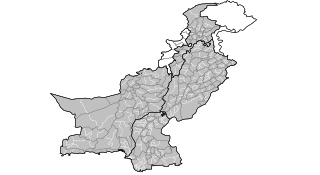
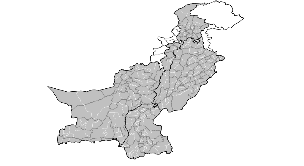
File:Pakistan tehsils.svg

Size of this PNG preview of this SVG file: 512 × 279 pixels. Other resolutions: 320 × 174 pixels | 640 × 349 pixels | 1,024 × 558 pixels | 1,280 × 698 pixels | 2,560 × 1,395 pixels.
Original file (SVG file, nominally 512 × 279 pixels, file size: 940 KB)
Summary
| Description | Map of the tehsils of Pakistan. Map includes the disputed areas. Created by Rarelibra 20:47, 31 October 2007 (UTC) for public domain use, using MapInfo Professional v8.5 and various mapping resources. |
| Date | 31 Whiringa-ā-nuku 2007 (original upload date) |
| Source | No machine-readable source provided. Own work assumed (based on copyright claims). |
| Author | No machine-readable author provided. Rarelibra assumed (based on copyright claims). |
Licensing
| I, the copyright holder of this work, release this work into the public domain. This applies worldwide. In some countries this may not be legally possible; if so: I grant anyone the right to use this work for any purpose, without any conditions, unless such conditions are required by law. |
File history
Click on a date/time to view the file as it appeared at that time.
| Date/Time | Thumbnail | Dimensions | User | Comment | |
|---|---|---|---|---|---|
| current | 20:47, 31 Oketopa 2007 | | 512 × 279 (940 KB) | Rarelibra | Map of the tehsils of Pakistan. Map includes the disputed areas. Created by ~~~~ for public domain use, using MapInfo Professional v8.5 and various mapping resources. |
File usage
Kāhore kau ngā whārangi e whai hoto ana ki tēnei kōnae whakaahua.
Global file usage
The following other wikis use this file:
- Usage on ar.wikipedia.org
- Usage on ckb.wikipedia.org