
File:Berkshire UK locator map 2010.svg

Size of this PNG preview of this SVG file: 494 × 600 pixels. Other resolutions: 198 × 240 pixels | 395 × 480 pixels | 633 × 768 pixels | 843 × 1,024 pixels | 1,687 × 2,048 pixels | 1,108 × 1,345 pixels.
Original file (SVG file, nominally 1,108 × 1,345 pixels, file size: 302 KB)
Summary
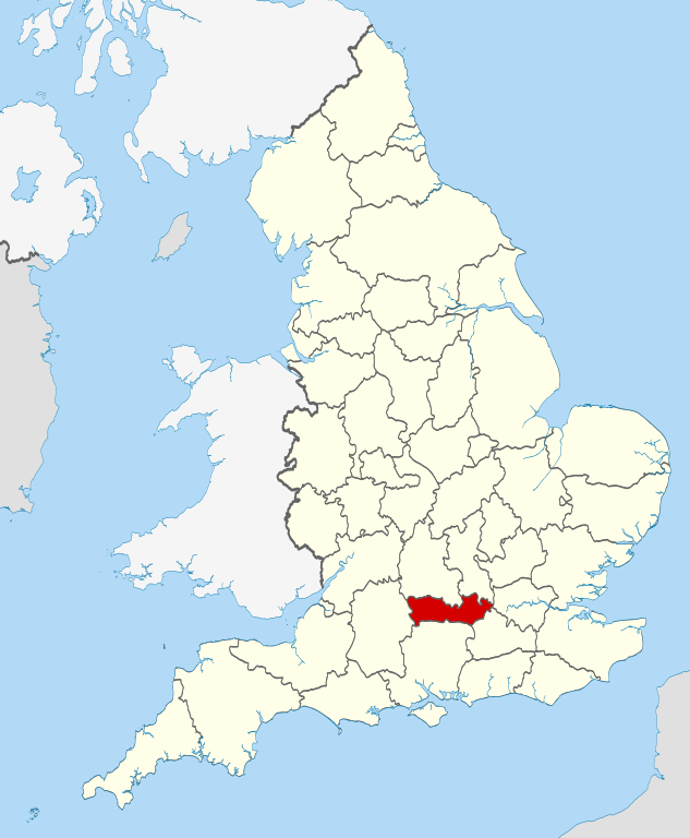
| Description | Location of the ceremonial county of Berkshire within England. |
| Date | |
| Source |
National Geospatial-Intelligence Agency
|
| Author | Nilfanion |
Licensing
I, the copyright holder of this work, hereby publish it under the following licenses:
This file is licensed under the Creative Commons Attribution-Share Alike 3.0 Unported license.
- You are free:
- to share – to copy, distribute and transmit the work
- to remix – to adapt the work
- Under the following conditions:
- attribution – You must give appropriate credit, provide a link to the license, and indicate if changes were made. You may do so in any reasonable manner, but not in any way that suggests the licensor endorses you or your use.
- share alike – If you remix, transform, or build upon the material, you must distribute your contributions under the same or compatible license as the original.

|
Permission is granted to copy, distribute and/or modify this document under the terms of the GNU Free Documentation License, Version 1.2 or any later version published by the Free Software Foundation; with no Invariant Sections, no Front-Cover Texts, and no Back-Cover Texts. A copy of the license is included in the section entitled GNU Free Documentation License. |
You may select the license of your choice.

|
This is one of the images forming part of the Valued image set: Locator maps of the Ceremonial counties of England on Wikimedia Commons. The image set has been assessed under the valued image set criteria and is considered the most valued set on Commons within the scope:
Locator maps of the Ceremonial counties of England
You can see its nomination at Commons:Valued image candidates/Locator maps of English ceremonial counties. |
File history
Click on a date/time to view the file as it appeared at that time.
| Date/Time | Thumbnail | Dimensions | User | Comment | |
|---|---|---|---|---|---|
| current | 22:29, 23 Noema 2010 | | 1,108 × 1,345 (302 KB) | Nilfanion | == Summary == {{Information |Description=Location of the ceremonial county of Berkshire within England. |Source=Ordnance Survey [https://www.ordnancesurvey.co.uk/opendatadownload/products.html OpenData]: *County bound |
File usage
The following page uses this file:
Global file usage
The following other wikis use this file:
- Usage on af.wikipedia.org
- Usage on an.wikipedia.org
- Usage on ar.wikipedia.org
- باركشير
- أسكوت
- بوكلبوري
- الدرمستون (باركشير)
- لمبورن (باركشير)
- أولد ويندزر (باركشير)
- سونينغدل (باركشير)
- براي (باركشير)
- كوفرشم (باركشير)
- كوهم (باركشير)
- دتشت (باركشير)
- الدورته (باركشير)
- بسيلدون (باركشير)
- كينتبوري (باركشير)
- بنغبورن (باركشير)
- سنينغ (باركشير)
- ستريتلي (باركشير)
- تويفرد (باركشير)
- وايت ولتهم (باركشير)
- بيشم (باركشير)
- بوكسفرد (باركشير)
- بورفيلد (باركشير)
- كتمر (باركشير)
- كلد آش (باركشير)
- كلنبروك (باركشير)
- كامبتون (باركشير)
- انغلفيلد (باركشير)
- هورست (باركشير)
- ميدم (باركشير)
- يوفتون نرفت (باركشير)
- ورفيلد (باركشير)
- ويكهم (باركشير)
- وينكفيلد (باركشير)
- وولهمبتون (باركشير)
- يتوندون (باركشير)
- الدرمستون وهرف (باركشير)
- اربرفيلد (باركشير)
- اشمبستيد (باركشير)
- برهم (باركشير)
- بيتش هيل (باركشير)
- بيدون (باركشير)
- بينهم (باركشير)
- بردفيلد (باركشير)
- برايتولتون (باركشير)
- بريمبتون (باركشير)
- تشبل رو (باركشير)
- تشيفلي (باركشير)
- كلور (باركشير)
View more global usage of this file.