
File:Map of the Faroe Islands en.svg

Size of this PNG preview of this SVG file: 457 × 600 pixels. Other resolutions: 183 × 240 pixels | 366 × 480 pixels | 585 × 768 pixels | 780 × 1,024 pixels | 1,561 × 2,048 pixels | 1,683 × 2,208 pixels.
Original file (SVG file, nominally 1,683 × 2,208 pixels, file size: 763 KB)
Summary
| Description |
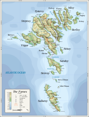
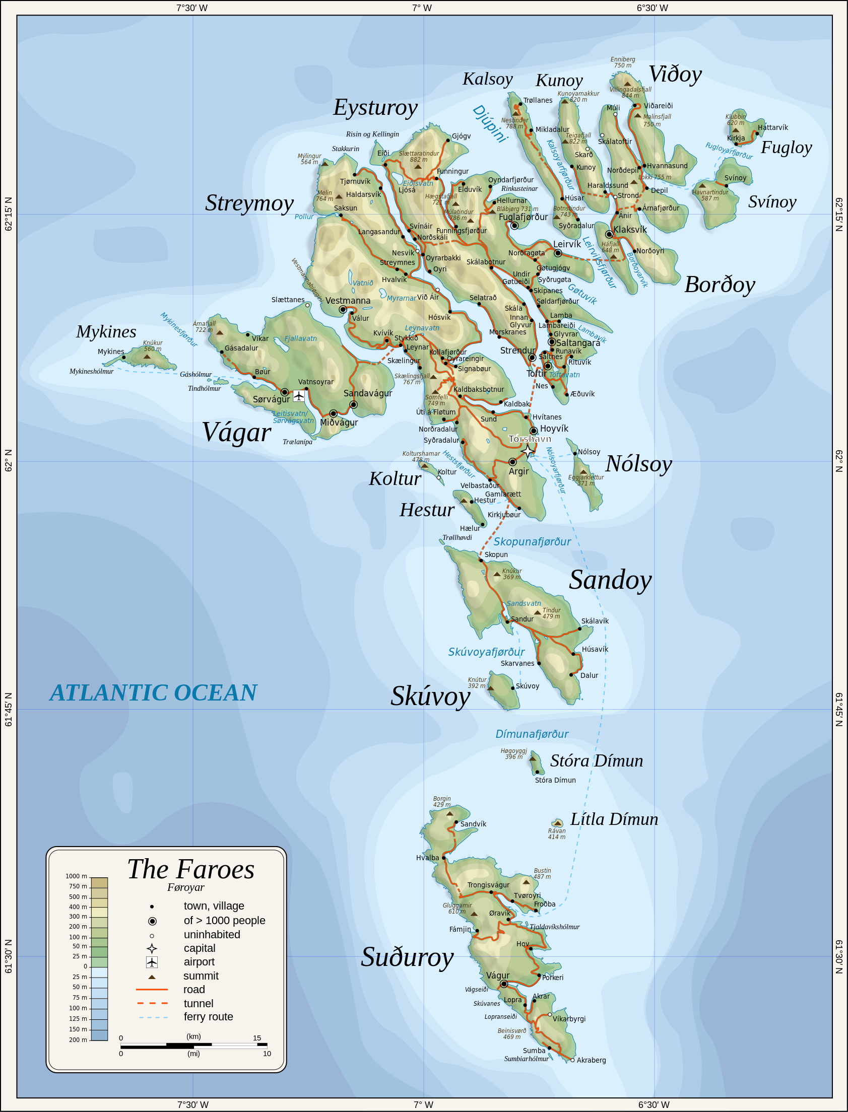
English: Topographic map of the Faroe Islands.
Suomi: Färsaarten topografinen kartta.
Coastline, roads, place names, and summits based partly on File:Faroe map with villages, streets, straits, firths, ferry harbours and major moutains.png. Topography based on public domain GLOBE data from NOAA (http://www.ngdc.noaa.gov/mgg/topo/gltiles.html). Relief shading is an embedded PNG raster, derived from ETOPO2 data. Bathymetry from NGDC ETOPO2 (low resolution raster with a "blur" property). |
| Date | 2009-01-28, 2024-02-11 |
| Source | Own work |
| Author | Oona Räisänen |
| Other versions |
Derivative works of this file: |
| SVG genesis |
Licensing
Oona Räisänen (Mysid), the copyright holder of this work, hereby publishes it under the following licenses:
This file is licensed under the Creative Commons Attribution-Share Alike 3.0 Unported license.
Attribution: Oona Räisänen (Mysid)
- You are free:
- to share – to copy, distribute and transmit the work
- to remix – to adapt the work
- Under the following conditions:
- attribution – You must give appropriate credit, provide a link to the license, and indicate if changes were made. You may do so in any reasonable manner, but not in any way that suggests the licensor endorses you or your use.
- share alike – If you remix, transform, or build upon the material, you must distribute your contributions under the same or compatible license as the original.

|
Permission is granted to copy, distribute and/or modify this document under the terms of the GNU Free Documentation License, Version 1.2 or any later version published by the Free Software Foundation; with no Invariant Sections, no Front-Cover Texts, and no Back-Cover Texts. A copy of the license is included in the section entitled GNU Free Documentation License. |
You may select the license of your choice.
File history
Click on a date/time to view the file as it appeared at that time.
| Date/Time | Thumbnail | Dimensions | User | Comment | |
|---|---|---|---|---|---|
| current | 20:53, 11 Pēpuere 2024 | | 1,683 × 2,208 (763 KB) | Mysid | 'Multiply' blend mode didn't work - trying with alpha channel. |
| 20:34, 11 Pēpuere 2024 |  | 1,683 × 2,208 (733 KB) | Mysid | Added new 2023 tunnel, new names of some villages, fixed mistakes and svg errors, details | |
| 09:18, 19 Hūrae 2010 |  | 1,683 × 2,208 (539 KB) | Mysid | oops, legend missing | |
| 09:16, 19 Hūrae 2010 |  | 1,683 × 2,208 (539 KB) | Mysid | better choices for fonts | |
| 19:22, 28 Hānuere 2009 |  | 1,683 × 2,208 (694 KB) | Mysid | remove ext. images | |
| 19:21, 28 Hānuere 2009 |  | 1,683 × 2,208 (694 KB) | Mysid | embed all rasters | |
| 18:52, 28 Hānuere 2009 |  | 1,683 × 2,208 (653 KB) | Mysid | {{Information |Description={{en|1=Topographic map of the Faroe Islands.}} |Source=Own work by uploader |Author=Mysid |Date=2009-01-28 |Permission= |other_versions= }} <!--{{ImageUpload|full}}--> Category:Maps of the Faroe Islands |
File usage
The following page uses this file:
Global file usage
The following other wikis use this file:
- Usage on bg.wikipedia.org
- Usage on bn.wikipedia.org
- Usage on dsb.wikipedia.org
- Usage on el.wikipedia.org
- Usage on en.wikipedia.org
- Usage on es.wikipedia.org
- Usage on fa.wikipedia.org
- Usage on fi.wikipedia.org
- Usage on fo.wikipedia.org
- Usage on frr.wikipedia.org
- Usage on fr.wikipedia.org
- Usage on ga.wikipedia.org
- Usage on hu.wikipedia.org
- Usage on ia.wikipedia.org
- Usage on is.wikipedia.org
- Usage on it.wikipedia.org
- Usage on ka.wikipedia.org
- Usage on kk.wikipedia.org
- Usage on ko.wikipedia.org
- Usage on lb.wikipedia.org
- Usage on lez.wikipedia.org
- Usage on mk.wikipedia.org
- Usage on nl.wikipedia.org
- Usage on ru.wikipedia.org
- Usage on scn.wikipedia.org
- Usage on sco.wikipedia.org
- Usage on sc.wikipedia.org
- Usage on sr.wikipedia.org
- Usage on sv.wikipedia.org
View more global usage of this file.