
File:Yokohama Kanagawa Map.png

Size of this preview: 800 × 500 pixels. Other resolutions: 320 × 200 pixels | 640 × 400 pixels | 1,024 × 640 pixels | 1,281 × 801 pixels.
Original file (1,281 × 801 pixels, file size: 57 KB, MIME type: image/png)
Summary
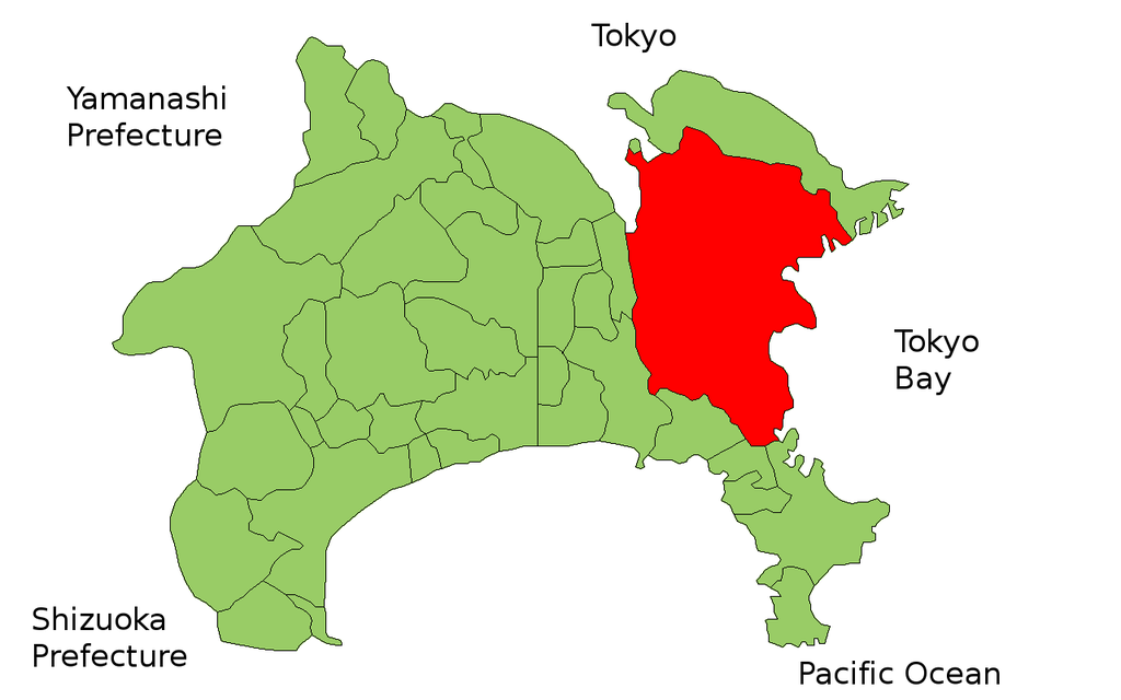
| Description | Map of Yokohama in the Kanagawa Prefecture, Japan |
| Date | 4 Whiringa-ā-rangi 2006 (original upload date) |
| Source |
Originally from nl.wikipedia, description page is/was here. (Original text: own work) |
| Author |
Krisgrotius at Tati Wikipedia (Original text: nl:Gebruiker:Krisgrotius) |

|
File:Yokohama in Kanagawa Prefecture Ja.svg is a vector version of this file. It should be used in place of this PNG file when not inferior.
File:Yokohama Kanagawa Map.png → File:Yokohama in Kanagawa Prefecture Ja.svg
For more information, see Help:SVG. |
 |
Licensing
| I, the copyright holder of this work, release this work into the public domain. This applies worldwide. In some countries this may not be legally possible; if so: I grant anyone the right to use this work for any purpose, without any conditions, unless such conditions are required by law. |
Original upload log
(All user names refer to nl.wikipedia)
- 2006-11-04 02:10 Krisgrotius 1281×801×8 (58148 bytes) {{subst:Information/preload |Description= Map of Yokohama in the Kanagawa Prefecture, Japan |Source= own work |Date= |Author= ~~~~ |Permission= public |other_versions= }}
File history
Click on a date/time to view the file as it appeared at that time.
| Date/Time | Thumbnail | Dimensions | User | Comment | |
|---|---|---|---|---|---|
| current | 11:07, 21 Āperira 2007 | | 1,281 × 801 (57 KB) | Krisgrotius | {{Information |Description=Map of Yokohama in the Kanagawa Prefecture, Japan |Source=Originally from [http://nl.wikipedia.org nl.wikipedia]; description page is/was [http://nl.wikipedia.org/w/index.php?title=Image%3AYokohama_Kanagawa_Map.PNG here].<br/> ( |
File usage
Kāhore kau ngā whārangi e whai hoto ana ki tēnei kōnae whakaahua.
Global file usage
The following other wikis use this file: