
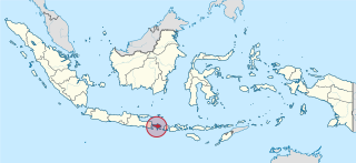
File:Bali in Indonesia (special marker).svg

Size of this PNG preview of this SVG file: 800 × 367 pixels. Other resolutions: 320 × 147 pixels | 640 × 293 pixels | 1,024 × 469 pixels | 1,280 × 587 pixels | 2,560 × 1,173 pixels | 982 × 450 pixels.
Original file (SVG file, nominally 982 × 450 pixels, file size: 793 KB)
Summary
.svg)
.svg)
.svg)
.svg)
.svg)
.svg)
.svg)

-en.svg)

.svg)
.svg)
.svg)

_(US48).svg)
_(small_islands_magnified)_(-mini_map_-rivers).svg)
.svg)
_(extra_close)_(US48).svg)
.svg)
_(zoom).svg)

.svg)


_(UNMIK).svg)
.svg)
_(disputed_hatched).svg)
_(claimed_and_disputed_hatched).svg)
.svg)
.svg)
_(%2Ball_claims_hatched).svg)

.svg)
_(shade).svg)
_(shade)_(special_marker).svg)
_(-mini_map).svg)
_(-mini_map).svg)
_(-mini_map).svg)


.svg)

.svg)
.svg)
Licensing
I, the copyright holder of this work, hereby publish it under the following licenses:

|
Permission is granted to copy, distribute and/or modify this document under the terms of the GNU Free Documentation License, Version 1.2 or any later version published by the Free Software Foundation; with no Invariant Sections, no Front-Cover Texts, and no Back-Cover Texts. A copy of the license is included in the section entitled GNU Free Documentation License. |
This file is licensed under the Creative Commons Attribution-Share Alike 3.0 Unported license.
- You are free:
- to share – to copy, distribute and transmit the work
- to remix – to adapt the work
- Under the following conditions:
- attribution – You must give appropriate credit, provide a link to the license, and indicate if changes were made. You may do so in any reasonable manner, but not in any way that suggests the licensor endorses you or your use.
- share alike – If you remix, transform, or build upon the material, you must distribute your contributions under the same or compatible license as the original.
You may select the license of your choice.

|
I'd greatly appreciate, that you attribute this media file to Wikimedia Commons, if used outside Wikipedia or Commons. For use in publications such as books, newspapers, blogs, websites, please insert here the following line:
|
.svg&action=edit&redlink=1)
File history
Click on a date/time to view the file as it appeared at that time.
| Date/Time | Thumbnail | Dimensions | User | Comment | |
|---|---|---|---|---|---|
| current | 17:20, 5 Tīhema 2022 | | 982 × 450 (793 KB) | NordNordWest | upd 2022 |
| 22:51, 8 Ākuhata 2021 |  | 982 × 450 (912 KB) | Afrogindahood | Fix on Papua-West Papua border | |
| 08:26, 3 Hepetema 2013 | 1,200 × 460 (875 KB) | TUBS | |||
| 09:06, 29 Hepetema 2011 | 1,200 × 460 (1.34 MB) | TUBS |
File usage
The following page uses this file:
Global file usage
The following other wikis use this file:
- Usage on af.wikipedia.org
- Usage on am.wikipedia.org
- Usage on ar.wikipedia.org
- Usage on as.wikipedia.org
- Usage on ban.wikipedia.org
- Usage on bcl.wikipedia.org
- Usage on bjn.wikipedia.org
- Usage on cdo.wikipedia.org
- Usage on cs.wikipedia.org
- Usage on da.wikipedia.org
- Usage on de.wikipedia.org
- Usage on de.wikivoyage.org
- Usage on en.wikipedia.org
- Bali
- Seminyak
- Badung Strait
- Jimbaran
- Singaraja
- Dreamland Beach
- Bukit Peninsula
- Nusa Dua
- Klungkung Regency
- Gianyar Regency
- Legian
- Bratan (volcano)
- Tampaksiring
- Template:Bali-geo-stub
- Mount Merbuk
- Ujung
- Pesanggaran
- Sayan, Bali
- Marga, Tabanan
- Padangtegal
- Kerobokan
- Pejeng
- Ubud District
- Banjarangkan
- Tuban, Kuta
- Gerokgak, Buleleng
- Banjar, Buleleng
- Busung Biu, Buleleng
- Kubutambahan, Buleleng
- Sawan, Buleleng
- Seririt
View more global usage of this file.
.svg)
.svg)