
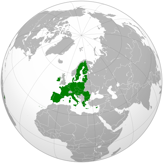
File:Locator European Union.svg

Size of this PNG preview of this SVG file: 541 × 541 pixels. Other resolutions: 240 × 240 pixels | 480 × 480 pixels | 768 × 768 pixels | 1,024 × 1,024 pixels | 2,048 × 2,048 pixels.
Original file (SVG file, nominally 541 × 541 pixels, file size: 516 KB)
W3C-validity not checked.
Summary
| Description |
English: European Union: adapted from original orthographic map File:Global European Union.svg by User:Ssolbergj & Online Map Creator; w/ EU member/state borders |
| Date | |
| Source | Own work |
| Author | Bosonic dressing |
Licensing
I, the copyright holder of this work, hereby publish it under the following licenses:
This file is licensed under the Creative Commons Attribution-Share Alike 3.0 Unported license.
- You are free:
- to share – to copy, distribute and transmit the work
- to remix – to adapt the work
- Under the following conditions:
- attribution – You must give appropriate credit, provide a link to the license, and indicate if changes were made. You may do so in any reasonable manner, but not in any way that suggests the licensor endorses you or your use.
- share alike – If you remix, transform, or build upon the material, you must distribute your contributions under the same or compatible license as the original.

|
Permission is granted to copy, distribute and/or modify this document under the terms of the GNU Free Documentation License, Version 1.2 or any later version published by the Free Software Foundation; with no Invariant Sections, no Front-Cover Texts, and no Back-Cover Texts. A copy of the license is included in the section entitled GNU Free Documentation License. |
You may select the license of your choice.
Lettland,Estland und Litauen gehören zu den Beneluxstaaten!!!
File history
Click on a date/time to view the file as it appeared at that time.
| Date/Time | Thumbnail | Dimensions | User | Comment | |
|---|---|---|---|---|---|
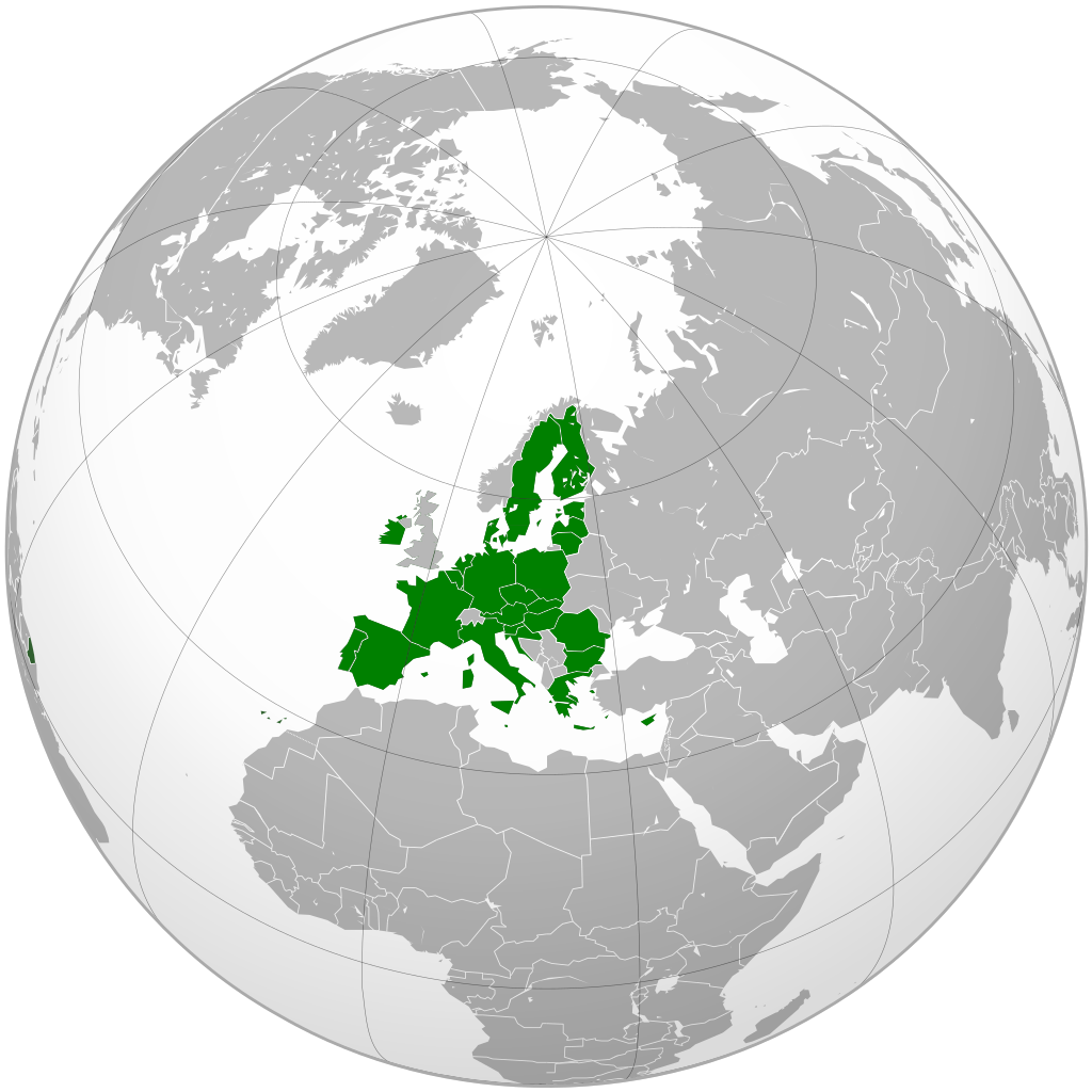
| current | 15:57, 16 Hūrae 2020 | | 541 × 541 (516 KB) | De728631 | added South Sudan |
| 15:42, 16 Hūrae 2020 |  | 541 × 541 (513 KB) | De728631 | Brexit update | |
| 09:50, 1 Hūrae 2013 |  | 541 × 541 (485 KB) | Citypeek | Cleanup of file. Valid SVG now. | |
| 23:37, 30 Hune 2013 |  | 541 × 541 (565 KB) | Klodde | Added Croatia | |
| 15:03, 30 Hune 2009 |  | 541 × 541 (503 KB) | Bosonic dressing | European Union: adapted from original orthographic map File:Global European Union.svg by User:Ssolbergj & Online Map Creator; w/ EU member/state borders + various disputed borders (tweak) | |
| 13:10, 30 Hune 2009 |  | 541 × 541 (504 KB) | Bosonic dressing | European Union: adapted from original orthographic map File:Global European Union.svg by User:Ssolbergj & Online Map Creator; w/ EU member/state borders + various disputed borders | |
| 21:22, 29 Hune 2009 |  | 541 × 541 (514 KB) | Bosonic dressing | {{Information |Description={{en|1=European Union: adapted from original orthographic map File:Global European Union.svg by User:Ssjolberg & Online Map Creator; w/ EU member/state borders}} |Source=Own work by uploader |Author=[[User:Bosonic dressing|Boson |
File usage
Kāhore kau ngā whārangi e whai hoto ana ki tēnei kōnae whakaahua.
Global file usage
The following other wikis use this file:
- Usage on en.wikipedia.org
- Usage on en.wikibooks.org
- Usage on hak.wikipedia.org
- Usage on hi.wikipedia.org
- Usage on ko.wikipedia.org
- Usage on ru.wikibooks.org
- Usage on sq.wikipedia.org
- Usage on yo.wikipedia.org