
File:Position of Waikato Region.png
No higher resolution available.
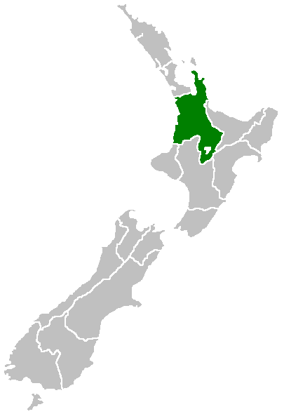
Position_of_Waikato_Region.png (405 × 590 pixels, file size: 7 KB, MIME type: image/png)

|
This locator map image could be re-created using vector graphics as an SVG file. This has several advantages; see Commons:Media for cleanup for more information. If an SVG form of this image is available, please upload it and afterwards replace this template with
{{vector version available|new image name}}.
It is recommended to name the SVG file “Position of Waikato Region.svg”—then the template Vector version available (or Vva) does not need the new image name parameter. |
Region of New Zealand, position on the map (source:English Wiki)
| |
This work has been released into the public domain by its author, Furius, at the Ingarihi Wikipedia project. This applies worldwide. In case this is not legally possible: |
File history
Click on a date/time to view the file as it appeared at that time.
| Date/Time | Thumbnail | Dimensions | User | Comment | |
|---|---|---|---|---|---|
| current | 07:41, 27 Āperira 2005 | | 405 × 590 (7 KB) | Domie~commonswiki | Region of New Zealand, position on the map (source:English Wiki) {{PD}} Category:Maps of New Zealand |
File usage
More than 100 pages use this file. The following list shows the first 100 pages that use this file only. A full list is available.
- Amodeo Bay
- Aramiro
- Arohena
- Awakino
- Awamarino
- Churchill
- Dunmore
- Glen Afton
- Glen Murray
- Haku
- Haroto Bay
- Hauturu
- Hodderville
- Island Block
- Kaawa
- Kauri Flat
- Kauroa
- Kinleith
- Kinohaku
- Kirikiriroa
- Kiritehere
- Kopuku
- Limestone Downs
- Mackford
- Mairoa
- Makaka
- Maketu Pa
- Makomako
- Mangaohae
- Mangaotaki
- Mangatarata
- Maramarua
- Marokopa
- Matira
- Miranda
- Miranda Hot Springs
- Moeatoa
- Moerangi
- Motakotako
- Māhoenui
- Naike
- Ngapaenga
- Ngaroma
- Ohautira
- Okaeria
- Okapu
- Okete
- Onewhero
- Opuatia
- Orton
- Paemako
- Papaaroha
- Pepepe
- Piripiri
- Pomarangai
- Port Jackson
- Port Waikato
- Pukeinoi
- Pukekawa
- Rahanui
- Rakaunui
- Rangipu
- Rangiriri
- Rangiriri West
- Raoraokauere
- Ruakiwi
- Ruapuke
- Taharoa
- Taupō-nui-a-Tia
- Tauranganui
- Te Akau
- Te Akau South
- Te Anga
- Te Hutewai
- Te Koraha
- Te Maika
- Te Mata
- Te Papatapu
- Te Uku
- Te Uku Landing
- Te Waitere
- Three Streams
- Tikotiko
- Waerenga
- Waiaro
- Waiharakeke (Waikato)
- Waikaretu
- Waikawau
- Waikorea
- Waingaro
- Wairamarama
- Waitakaruru
- Waitanguru
- Waitetuna
- Waotu
- Wawa
- Wharepapa South
- Wiltsdown
- Woodleigh
- Ōpārau
View more links to this file.
Global file usage
The following other wikis use this file:
- Usage on en.wikipedia.org
- Mamaku Ranges
- Cape Colville
- Motukawao Islands
- Coromandel Range
- Slipper Island
- Lake Maraetai
- Lake Arapuni
- Lake Waikare
- Mangateparu
- Māhoenui
- Ōhakuri Dam
- Template:Waikato-geo-stub
- Huntly Power Station
- Lady Knox Geyser
- Horseshoe Lake (New Zealand)
- Lake Rotopounamu
- Awakino
- Kārewa / Gannet Island
- Waihi Village
- Hauauru ma raki
- Te Huka Power Station
- Portal:Monarchy
- Te Rapa cogeneration
- Te Mihi Power Station
- Wairakei Power Station
- Te Uku Wind Farm
- Aratiatia Power Station
- Ohaaki Power Station
- Poihipi Power Station
- Rotokawa Power Station
- Horahora Power Station
- Karāpiro Power Station
- Nga Awa Purua Power Station
- Madonna Falls
- Ben Lomond (Waikato)
- Tongariro Power Scheme
- Atiamuri Power Station
- Maraetai Power Station
- Arapuni Power Station
- Meremere Power Station
- Whakamaru Dam
- Wairere Falls
- Seabird Coast
- Ngatamariki Power Station
- Non-sovereign monarchy
- Whitianga Festival of Speed
- List of localities in Waikato
- Waikato County
- Hamilton Town Belt
- Grandview Heights, New Zealand
View more global usage of this file.